EssiAvellan.com
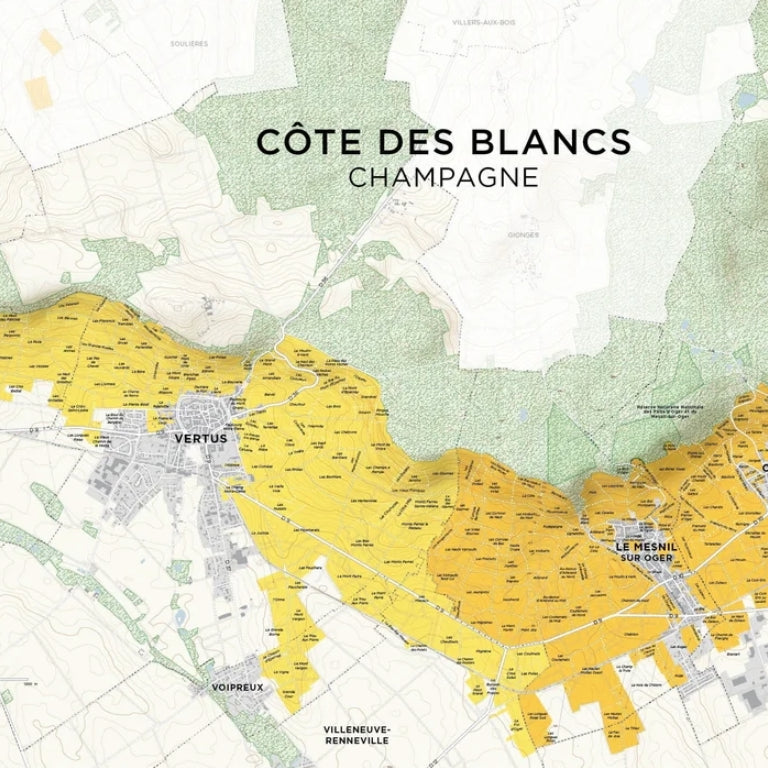
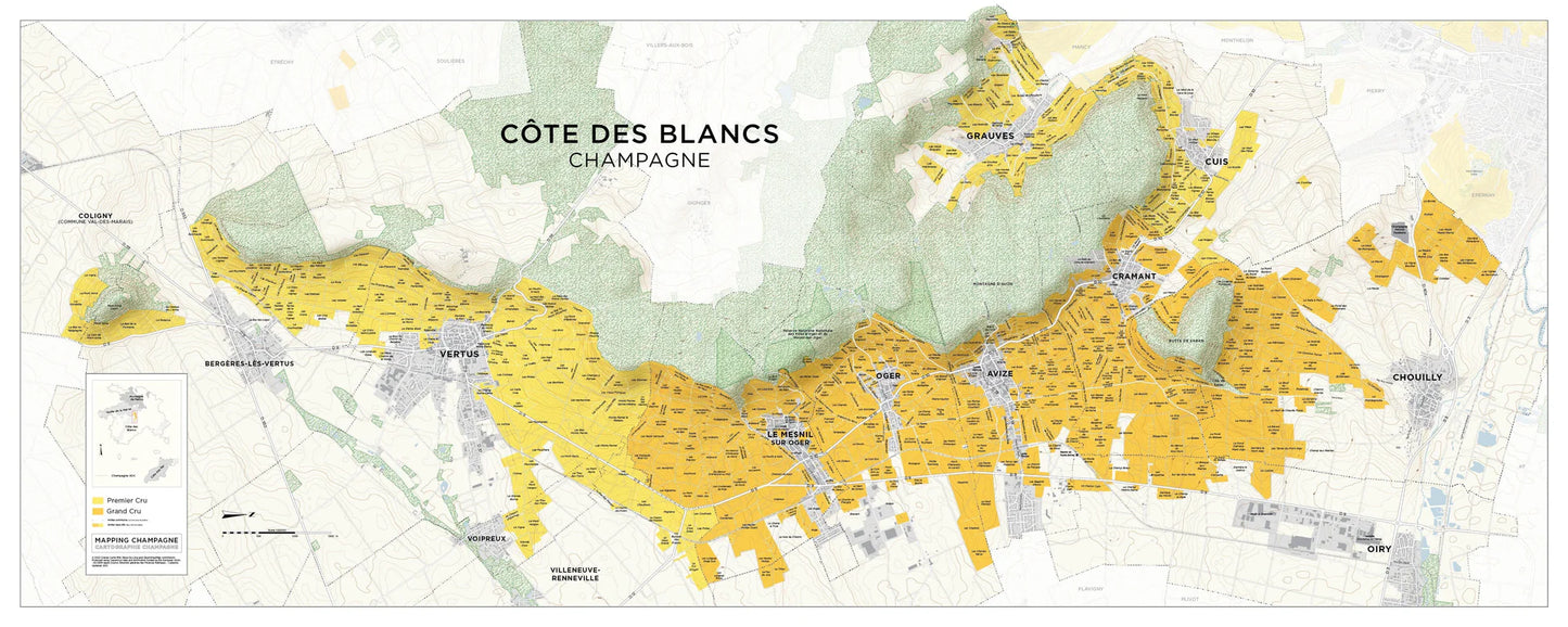
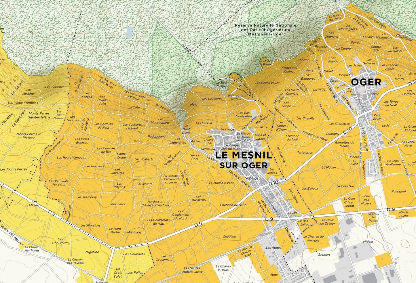
Mapping Champagne- Côte des Blancs Map
Mapping Champagne- Côte des Blancs Map
Couldn't load pickup availability
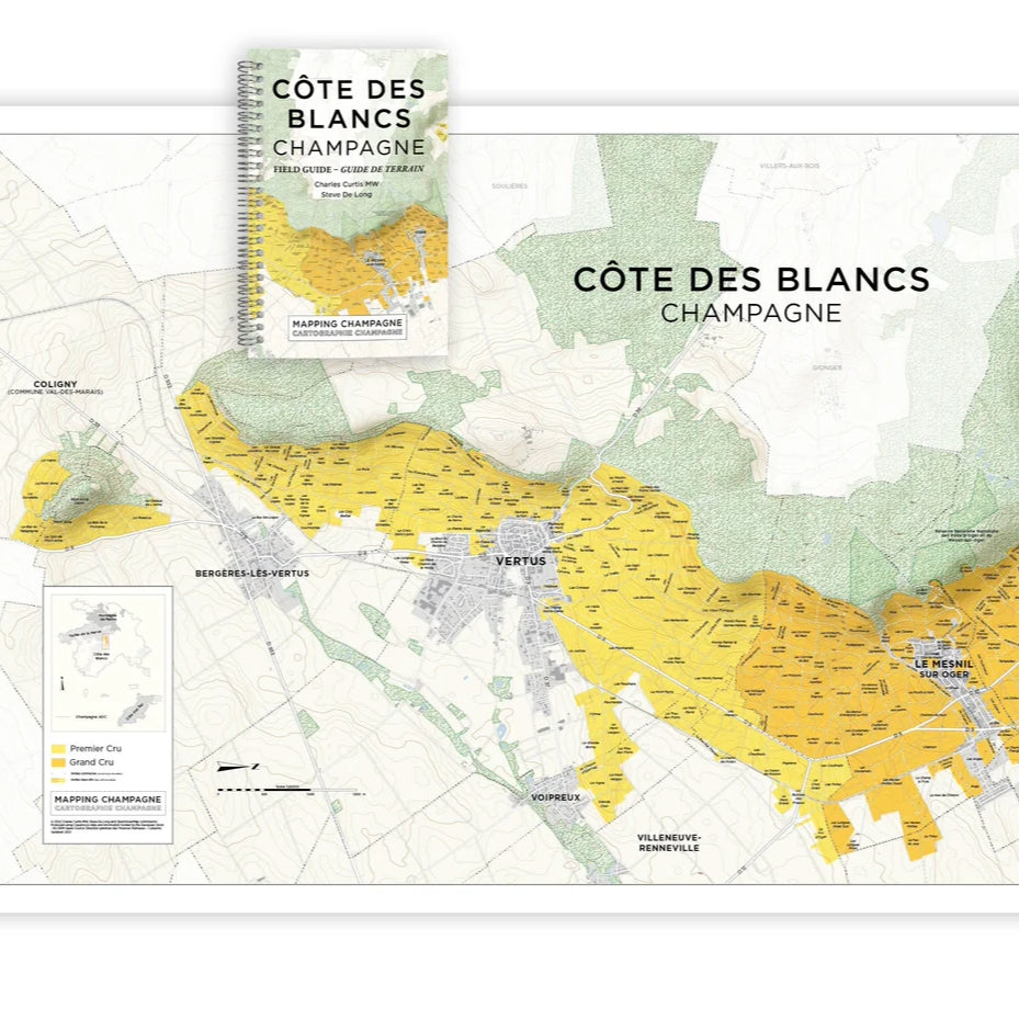
Map & Field Guide Bundle Offer – 115€
Simply add the
Field Guide and the Map to your cart, and the discounted price will be automatically applied at checkout.
Any Champagne lover knows how frustrating it has been trying to learn about the region’s complex terroirs practically without detailed and up-to-date maps. We have all relied on the original, pioneering maps of Louis Larmat from the 1940s. Finally Charles Curtis MW and Steve De Long came to rescue commencing a comprehensive mapping project of Champagne.
So far, the duo has published an overall map of Champagne’s wine regions and a detailed map of the Côte des Blancs. Villages below grand and premier cru status will not be dealt with in such detail, but Curtis and De Long are making proper illustrations of the poorly mapped, more recent areas of Champagne such as Montgueux and Coteaux du Petit Moran.
Currently the duo is working on the Montagne de Reims, and over the next few years the mapping will continue with the Vallée de la Marne, then the Côte des Bar. Then the enormous work will be compiled into an atlas of Champagne. Charles Curtis considers the Mapping Champagne project as an excellent chance to fulfill his career-long desire to define in detail the world-class terroirs of Champagne. For us wine lovers and professionals, Curtis’s and De Long’s work provides a fundamental and long-awaited tool for gaining a deeper understanding of the region. When the duo one day completes the task, I am sure we will have in our hands something as legendary and age-defying as the original Larmat maps.
In the July 2023 issue of The World of Fine Wine, Essi Avellan assessed the ambitious project and its first results. Read here the full article: https://worldoffinewine.com/news-features/mapping-champagne-book-revie
- Size: 150 x 60 cm
- Printing: Lithograph on 100# (150 gsm) mayte coated paper
To support the map, Curtis has created a bilingual French and English 120 page Field Guide booklet. Aiming to explain the configuration of each terroir—topography, exposure, and grape varieties—describing the parcels and the cuvées they produce. For each cru, he has compiled an index of lieux-dits and the winemakers based in each village.
Map & Field Guide Bundle Offer – 115€
Simply add the
Field Guide and the Map to your cart, and the discounted price will be automatically applied at checkout.
Share